Utilizing Satellites for Natural Disaster Management Ideas
Natural disasters, be they frequent low-intensity incidents or one-off catastrophic events, cause multi-billion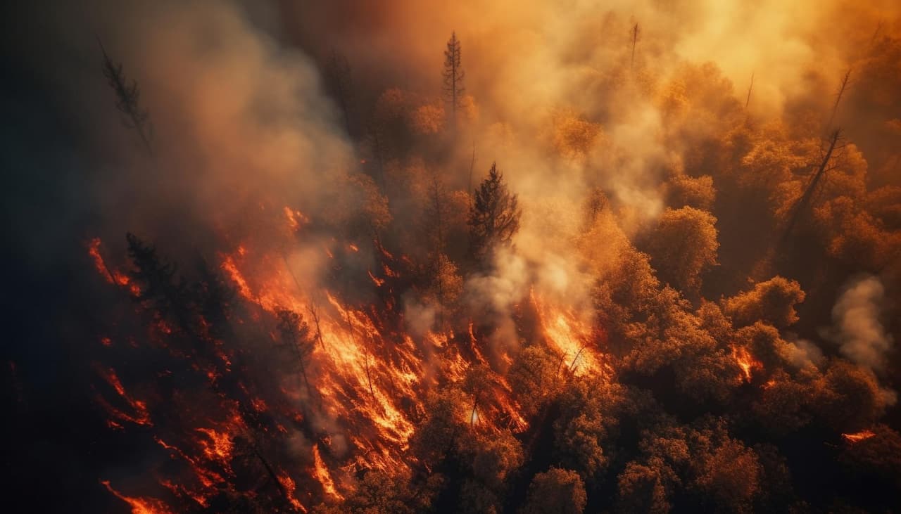 damage and affect millions of lives every year. Fueled by climate change, natural hazards have been on the rise, showing a tenfold increase compared to the last century. While preventing earthquakes or tsunamis is beyond our control, we can utilize the latest technological advances, such as satellite imagery, to minimize damage, save more lives, and ensure faster recovery when the next disaster strikes.
Satellite pictures of disaster locations captured at a distance of hundreds or thousands of miles above Earth prove more informative than on-site observations. Leveraging current satellite imaging capabilities, humanitarian actors and governments obtain crucial data that helps them along the entire disaster management cycle.
For instance, historical time series of satellite images are used in ground deformation studies to identify urban locations at risk of land subsidence. Sub-meter resolution imagery from rapidly tasked satellites can be visually assessed to pinpoint heavily affected areas where help is most needed and plan access routes that bypass ruined infrastructure. Further, spaceborne data will be useful in monitoring the progress of post-event reconstruction.
Early warning systems – a space-powered shield against disasters
The biggest challenge posed by natural hazards is their inherent unpredictability. Just as ancient tribes watched the skies for signs of bad weather, we now run long-term analysis of time series of satellite images using AI, to identify disaster precursors and forecast hazards as precisely and early as possible.
Early warning systems play an essential role in fostering disaster resilience in at-risk locations. They embrace disaster monitoring and prediction, risk assessment, communication, and preparedness activities, allowing to generate warnings and considerably reduce risks before the natural hazards happen.
Weather satellites that constantly monitor land and oceans from geostationary orbits can predict severe hydro-meteorological events like storms, cyclones, heatwaves, floods, or hurricanes up to several days ahead. Thanks to them, public and emergency responders have more time to alert people and effectively execute response plans.
Accurate hazard and risk maps created with remotely sensed data (optical, radar, LiDAR, etc.) largely improved early warning systems. Terrain analyses relying on LiDAR data provide the basis for risk assessment of floods, landslides, earthquakes, tsunamis, and wildfires. High-quality digital elevation models (DEMs) allow us to simulate the propagation of floods, tsunamis, landslides, and debris flow to locate hazard-prone areas, inform communities about the place and range of hazards, and estimate potential damage.
Measuring the extent of damage caused by natural disasters
Satellite-based Earth observations have a proven track record of supplying critical insights at times when transportation networks and communications are disrupted, affected terrains are inaccessible, and natural risks are still in place.
Local authorities and first responders often rely on the latest pictures of disaster-hit areas to make better decisions. Having eyes in space, they can effectively and quickly prioritize rescue efforts, allocate aid, and assess the extent of damage across territories as big as a country.
The combination of optical and radar satellite data speeds up and improves disaster damage estimation. Optical images of sub-meter resolution allow zooming in as close as to recognize damaged roads and rooftops, while radar satellites can monitor Earth’s surface under any weather conditions and at night.
Analyses carried out with the use of AI and ML technologies yield more detailed insights into how the landscape and infrastructure were affected. This way, an extensive satellite imagery time series dataset can be quickly processed to reveal previously unseen disaster patterns that might be of use in damage estimation or prediction of where the hazard is to spread.
How satellites enable earthquake disaster response and recovery
Let’s explore the role of satellite technologies in managing one of the deadliest geological hazards – earthquakes.
As an earthquake hits, the affected country can activate the International Charter “Space and Major Disasters” to immediately mobilize all participating Earth-observing satellites and obtain fresh images of the disaster-struck area within hours (or days) since the incident. Such remote assessment of damaged locations helps assess damage, guide rescue teams, plan evacuation routes, and determine the urgency and amount of aid required.
Satellite remote sensing data enables accurate monitoring of the progress of recovery efforts following the earthquake. In most cases, there are obvious indicators of infrastructure restoration or population migration that can be easily spotted from space: ongoing construction or emergence of new buildings, roads, and bridges; debris removal; removal of temporary shelters, and so on.
The major advantage in terms of earthquake recovery is that satellites provide long time series data. It becomes a vital tool for understanding if any positive changes are taking place, determine their rate, and evaluate the effectiveness of recovery strategies. Time series satellite data is also crucial for pinpointing areas with residual risk (prone to further damage) that should be monitored and taken care of first.
EOS Data Analytics capabilities in disaster damage assessment
EOS Data Analytics is a company that leverages satellite technologies and scientific expertise to support disaster management. The global provider of satellite imagery analytics has participated in various environmental studies and is open to partnerships with governmental agencies and scientific institutions aimed at the development of tools and custom models for disaster detection, damage assessment, and risk reduction.
By combining versatile satellite data with ground observations from local institutions, EOSDA can provide a comprehensive assessment of how hazards affected various sectors, such as trade or agriculture. The company delivers unparalleled insights into the environmental consequences of floods, earthquakes, wildfires, and other devastating natural hazards through its out-of-the-box and custom solutions, relying on multiple satellite data sources and cutting-edge proprietary algorithms.
With the launch of its own EOS SAT constellation, EOS Data Analytics will secure its major advantage among remote sensing companies in the context of natural disasters. Seven satellites will cover 10,000,000 square kilometers daily, capturing high-quality imagery in 13 spectral bands and further enhancing the timeliness and accuracy of damage assessment.
2022’s largest natural disasters as seen from space
In 2022 alone, natural calamities caused global losses estimated at $275 billion. Let’s look at some of them in time series satellite images.
New Mexico wildfire
Source: EOS Data Analytics: A massive wildfire in May 2022, the largest in New Mexico`s recorded history
In the spring of 2022, New Mexico State suffered the most devastating blaze on record. In 40 days, it burned an area the size of Los Angeles, destroying hundreds of buildings and a large forest area east of Santa Fe.
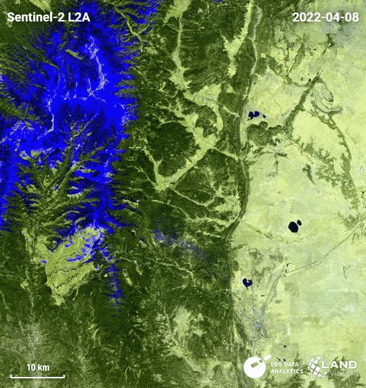
Pakistan floods
The monsoon season of 2022 caused devastating flooding in the most populous province in Pakistan. Settlements in or near the Indus River basin were affected the most. Hundreds of homes were washed away, over 1,500 square kilometers of land were waterlogged, and 700 people lost their lives.
Source: EOS Data Analytics- The EOSDA LandViewer satellite images show the view of the Indus River basin in Pakistan after heavy rains and flooding caused by the monsoon season in August, 2022.
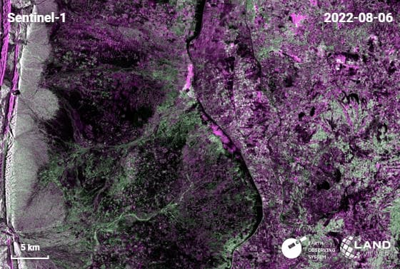
China earthquake
A 6.6 earthquake hit the Sichuan province of China on September 5, 2022. The magnitude was high enough for tremors to be felt hundreds of kilometers away from the epicenter. The quake became one of the largest in the province’s history, causing landslides and road collapses.
Tornadoes in the South of the US
In March 2022, a series of fierce thunderstorms caused four tornadoes in Southeast Louisiana and Southern Mississippi. The most severe wind gusts exceeding 80 kilometers per hour were registered in the north of Jackson County, Mississippi.
Satellite imagery has proven its worth in all stages of disaster management, ensuring timely delivery of critical data about the magnitude and extent of damage wreaked by natural hazards across the globe. Coupling it with advanced AI algorithms increases the accuracy and value of damage assessments, enabling more effective and rapid response by public agencies and humanitarian actors. By harnessing the power of remote sensing analysis and satellite imagery time series, we can now identify disaster precursors more clearly and prepare for the coming natural risks ahead of time, minimizing damage to both infrastructure and human populations.